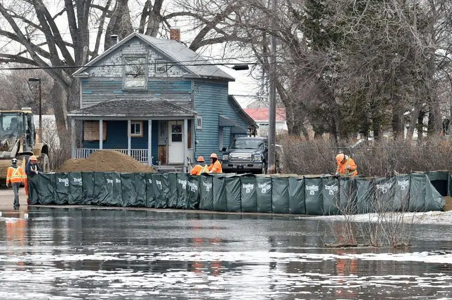
Flooding from the Swift Current Creek last week left the area under a local state of emergency that remains in place, but the risk of flooding in the area has tapered off.
That’s according to Saskatchewan’s Water Security Agency (WSA), which issued an update on spring runoff conditions Tuesday afternoon.
The WSA said runoff is still anticipated in the Swift Current Creek from further up in the basin, but weather and precipitation aren’t expected to increase the risk of floods.
Water flows in the City of Swift Current have dropped to 20 cubic metres per second from 105 cubic metres per second last week, the agency said, though that’s still well above the one- to two-cubic-metres-per-second level that’s normal for late April.
Outflows at the nearby Duncairn Dam have also dropped from 90 to 15 cubic metres per second since last week, the WSA noted.
Conditions around the province
The WSA said the Qu’Appelle River saw rapid melting last week, but the area isn’t expected to see significant flooding at this point.
While the risk of flooding is low, the agency noted that tributary flows are higher than normal and snow is in the forecast. As a result, the WSA said it’s increasing the peak elevation expectations for the Qu’Appelle Lakes, and those will be announced later this week or early next week.
“At this time, no significant impacts due to high water are expected, but ice may pose a risk if strong winds occur during ice breakup on the lakes resulting in ice shoves,” the WSA said in a statement.
“Strong winds can push ice onto the shore and against structures causing property damage.”
Most of the Qu’Appelle River is free of ice, the agency noted, which also helps reduce the potential for jams and flooding.
Last Mountain Lake isn’t expected to peak until late this month or early May, the WSA said, depending on conditions.
Buffalo Pound Lake is near its peak currently, the WSA noted, and water in that lake will slowly be released to minimize any impacts downstream.
Water levels in the Moose Jaw River are expected to drop in the coming days, the agency said. Ice has cleared along that river, with few ice jam issues spotted.
In the Old Wives Lake Basin, the agency said no communities are believed to be at risk. That said, Shamrock Regional Park may see some localized flooding.
Inflows are dropping rapidly at Thompson Lake, and flows are still high in Notukeu Creek after an advisory was issued Saturday.
At the Souris River, the risk of flooding is low for areas below the dams, the WSA said, and that risk is expected to stay low.
“There is, however, a risk of localized flooding related to the precipitation moving into the province (Tuesday) and continuing through Thursday,” the agency noted.
In the central parts of Saskatchewan, the agency said there are currently no issues with flooding, and no major risk is expected.
“Overall, the runoff response appears to be progressing as outlined in the WSA’s April 1 Spring Runoff Forecast,” the agency said.
While much of the province is expecting – or already seeing – snow, the WSA noted that “snow is better than rain as the moisture will be released slowly.”
Some localized flooding may occur in the coming days as that snow melts and makes its way into watercourses, the WSA said.


