

Listen to daily commentary from program director Murray Wood
Many people view Monday's election as one of the most important in Canada's history. Murray Wood breaks down the race an...
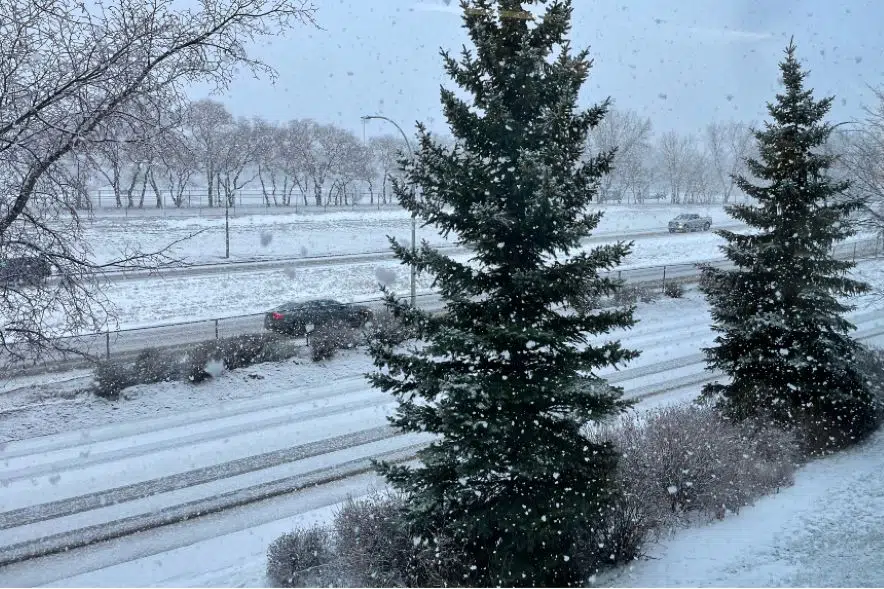
Another shot of snowy weather hit the province early on Monday morning, but Environment Canada forecaster Brad Vrolijk said it might not stay on the ground for long.
“Even if it sticks around for today, we do have quite a bit of warm air pushing into the region,” Vrolijk said early Monday. “Although it might stick around, it’s probably not going to be long until it’s gone.”
The small snowstorm pushing through southern Saskatchewan came from a system that formed in southern Alberta overnight. The snowstorm started in Kindersley and moved through Regina. It will leave through Estevan.
“It’s not overly heavy. Most areas are just seeing a couple of centimetres from it,” Vrolijk said.
Snowfall shouldn’t hit Saskatoon, with the northern edge of the snowstorm sitting 50 kilometres south of the city. Vrolijk said the storm has a sharp boundary that most likely would not budge.
The snowflakes should come to a stop around noon. Vrolijk said Environment Canada typically does not issue snowfall warnings unless a heavier snowfall of 10 cm in 12 hours rolls through.
“It’s more a quick dusting of snow this morning then it’s moving out,” he said.
Even light dustings of snow can produce slippery conditions, but Vrolijk was not concerned.
“I don’t expect that conditions will be too bad for too long since we do have warmer weather pushing into the region,” he said. “Most areas will climb up around the freezing mark early this afternoon.”
This season has seen warm temperatures because more air from the Pacific has moved through compared to air from the Arctic. More Pacific air has also led to less snow.
“We haven’t been setting any records as far as temperatures goes — or we haven’t so far, but it has been an unusually prolonged period of above-normal temperatures,” said Vrolijk.
This week will see a smorgasbord of weather from snow to rain. Environment Canada has both in the forecast on Thursday.
Vrolijk said the forecast has a low-pressure system expected to develop in the southwest corner of the province before tracking eastward along the Trans-Canada Highway corridor.
A push of warm air is expected to track alongside the system, which signals to Vrolijk that it could mostly be rain with a transition to freezing rain or snow as it goes northward to Saskatoon.
“Definitely on Thursday it is looking like a more organized system that is going to bring a winter mix to southern Saskatchewan,” he said.