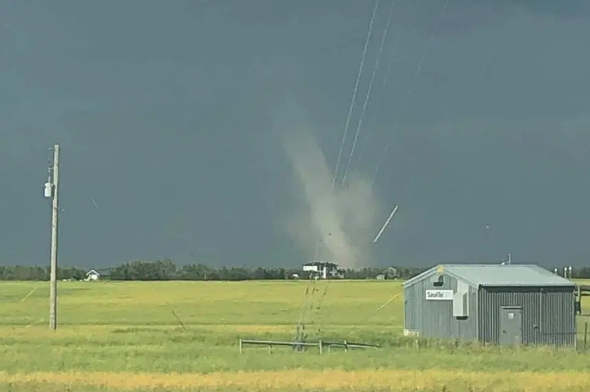
Environment Canada confirmed a tornado touched down near Lake Lenore Friday evening.
Its Shannon Moodie explained that they were alerted to the tornado by Saskatchewan’s emergency officials.
“There wasn’t any damage reported. It was a very weak tornado, something we call a landspout. So it happens just as a storm developing. There’s just some rotation in it that forms that funnel,” she said.
Moodie said they are able to confirm touch down based on the dust being kicked up by the tornado.
Along with the tornado, there was also quarter-sized hail in Broadview and nearly 50 mm, or just under two inches, in the Preeceville, Langenburg areas.
As we transition into the weekend, more severe weather could hit the province as well, according to Moodie.
“We actually have a set-up that is quite condusive to the development of supercells in the northern grain belt of Saskatchewan,” she explained when talking about Saturday night.
“There is a risk of tornados today. We’ll likely see watches being issued later today, this afternoon, that threat will last through the evening.”
The thunderstorm ⚡ outlook for Saturday August 22 has been updated – the threat level has expanded for central SK. #Stayweatheraware by downloading the WeatherCAN app on your cellphone and listen for warnings for any #skstorm pic.twitter.com/m8qd7Fxly8
— ECCC Weather Saskatchewan (@ECCCWeatherSK) August 21, 2020
Moodie said Saskatoon is right on the edge of the severe weather threat.
Regions in and around Melfort, Tisdale, Prince Albert, Meadow Lake and Humboldt are within the threat, outlined by Environment Canada.


