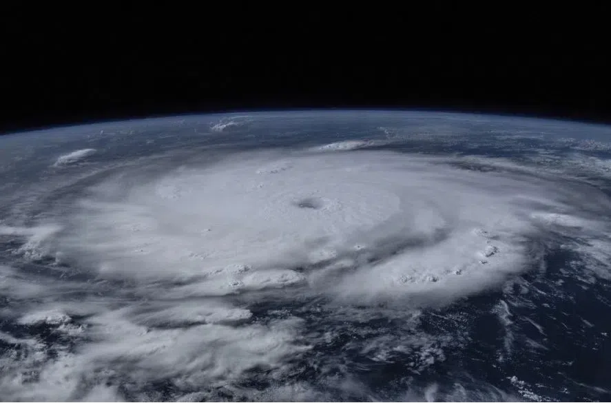
Florida braces for impact as Hurricane Milton barrels towards the state’s west coast.
The state was starting to pick up the pieces after Hurricane Helene is now preparing for another hard-hitting storm.
Milton has since weakened to a category four hurricane, and landfall is expected anytime between Wednesday, Oct. 9 in the night and Thursday, Oct. 10 in the morning.
Chris Fogarty, Canadian Hurricane Centre senior research meteorologist, Environment and Climate Change Canada joined Evan Bray to discuss Milton.
As Hurricane Milton continues its race towards the coast the category of the storm has changed a number of times.
Fogarty said this isn’t that strange with a storm the size of Milton.
“It is quite common for Hurricanes that are quite small and concentrated like this one,” said Fogarty. “The larger the hurricane is, the slower the changes are between the wind categories.”
Fogarty said Milton can strike Florida as a category two hurricane, although it is still projected to hit as a category four.
That would be the same category as Hurricane Helene which hit Florida just over a week ago.
But Fogarty said the two storms shouldn’t be compared.
“It’s like comparing the size of a pea to the size of an apple,” said Fogarty. “(They’re) very different in size.”
Milton is a very compact centre whereas Helene is a larger centre.
“Whoever gets hit with the very tight, very compact centre of Milton it will be really bad in that small area,” said Fogarty. “But Helene will probably still end up being worse than Milton… in terms of overall damage.”
Fogarty said Hurricanes require two key things to form and develop.
“The warm ocean water typically (needs to be) warmer than 26 Celsius,” said Fogarty. “Another key thing is that the atmosphere wind… has to be pretty much undisturbed all the way up.”
Read More:
- Sask. women ready to ride out Hurricane Milton in Orlando
- Foreign affairs min. urges Canadians to leave Florida ahead of hurricane
- Week 2: Evan Bray’s panel discusses ground game, younger voters
As a hurricane makes landfall it typically begins to weaken.
Fogarty said this is because the eye of the storm begins to deteriorate but sometimes that’s not always the case.
“If you have something like Helene that hits land but it merges with non-tropical weather fronts… that merging of weather systems can create really nasty conditions,” said Fogarty.
Residents in the path of Milton are being urged to evacuate while they can.


