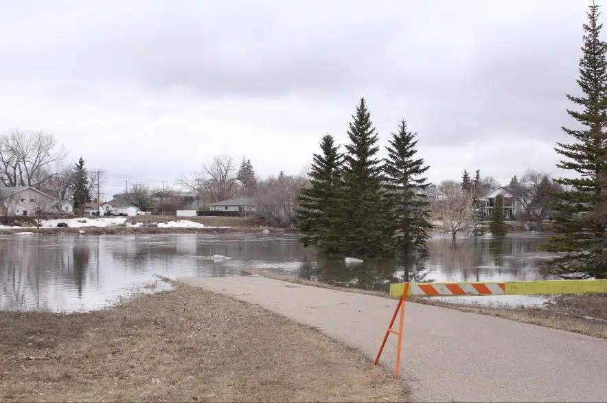
Saskatchewan’s Water Security Agency (WSA) says water levels in the Swift Current area are “stabilizing.”
Even though the city remains under a state of emergency – and has said it will be for up to two weeks – the agency said runoffs between Duncairn Dam and the city are declining.
“WSA is working to manage flows through the city by maximizing storage at Duncairn Dam (Reid Lake), keeping releases to a minimum, and diverting some water around the city using the Swift Current Main Canal,” the agency said in a media release Friday.
“Cooler temperatures (Thursday) and (Friday) have caused the melt and runoff to slow. The rain and snow received over the area over the past day is not expected to result in higher peak flows at this time.”
Swift Current’s fire chief said the water levels they’re seeing in the city right now are as high as they were during the floods of 1997 and 2011.
“We’re at peak levels that we’ve seen and we can handle with our system,” Ryan Hunter said Friday afternoon. “We’re estimating the water coming through the city of Swift Current is going to remain at peak levels for the next 10 to 14 days.”
During the floods of 1997 and 2011, people living in some low -lying areas had to be evacuated, but as of Friday, nobody had been forced to leave their homes.
Hunter credits the city’s engineers for helping build a more secure water channel to be able to take more water through the city.
While the water level is expected to remain stable over the next week, Hunter is asking those living in low-lying areas to remain alert.
“I would like to have the people in Swift Current to remain on notice if they live in low-lying areas,” he said.
He asked people to stay away from the water.
“Please stay away from the creek. The water is moving at such a fast pace and the currents are far stronger than we normally see, so the danger levels of being around the creek right now are extremely high,” he added.
Hunter said they’re also watching a weather system that could develop next Tuesday. That system could bring with it rain and snow. He says they’ll continue to check the forecast hourly.
The southwest has been inundated in the past week due to higher-than-expected runoff and melting that occurred faster than expected. Some highways in the province have been closed due to damage caused by the water.
The WSA said the Moose Jaw River is expected to reach its peak level on or about Sunday, but – unless ice jams form – there aren’t any issues expected, given the channel’s capacity.
Lakes in the Qu’Appelle River system also are expected to see peak inflows in the coming days.
The agency said there are above-normal flows in the system, but they’re consistent with the agency’s March and April runoff forecasts. The WSA noted it doesn’t expect to see “significant impacts from runoff at this time.”
There also are well-above-normal flows on the lower portions of the Frenchman River, the agency said.
According to the WSA, the situation is stable in the Thomson Lake and Wood River basin. There has been some localized flooding, but the agency said there hasn’t been any damage to infrastructure or buildings and flows now are receding in the basin.
The agency also noted there was a “rapid rise” in the flow on Long Creek, which led to the activation of the Boundary to Rafferty Diversion Canal on Thursday. Water is being diverted to Rafferty Reservoir, where the WSA said there’s ample storage.
The WSA update said the runoff in the northern and central areas of the province “will be similar to what was predicted in WSA’s April Snowmelt Runoff Update and will not be problematic.” However, it noted there could be localized flooding if there are ice jams.


