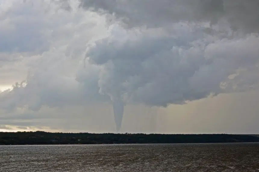
Environment Canada is reviewing why a tornado warning wasn’t issued before a twister touched down between Bethune and Regina Beach earlier in the week.
Meteorologist John Paul Cragg confirmed a severe thunderstorm watch was in place before that was upgraded to a severe thunderstorm warning. However, the weather office never did give a direct heads-up for the potential of a tornado.
“In this particular situation we just have to look back at what was there, what we could see, what we couldn’t and why the tornado warning wasn’t issued,” he explained.
There were no reports of injuries after the twister hit the ground about 10 kilometres northeast of Bethune Wednesday.
Cragg clarified severe thunderstorm warnings also include the possibility of tornadoes.
“That chance is pretty low in some thunderstorms, higher in others. But in a severe thunderstorm with the updraft as strong as it is, there’s always that chance that a tornado could occur,” he said.
Harsh weather can also sometimes spring up quickly in areas Environment Canada isn’t totally expecting; Cragg said the Bethune tornado is a good example.
“We were looking at the potential for tornadoes more in the Yorkton area and in Manitoba. That cell popped up,” he said.
“It was quite strong, but it was in a part of the area of low pressure where we didn’t expect a tornado like what occurred to occur.”
Environment Canada has counted 11 tornadoes in Saskatchewan so far in 2016. Cragg said they are working to confirm what is likely number 12 by Yorkton, also from Wednesday.
He added the tornado season typically peaks in July and usually ends by September.


